For generations, farming has been a profession deeply rooted in intuition, family traditions, and a bit of guesswork. Farmers looked at the sky, felt the soil with their hands, and made their best estimates on when to plant, how much to water, and when to harvest. While these time-tested methods laid the foundation for modern civilization, today’s agricultural landscape presents entirely new challenges.
Climatic volatility, severe water scarcity, depleted soil profiles, and skyrocketing input costs mean that relying on gut instinct alone is no longer enough to stay profitable. The modern farming sector operates on razor-thin margins. To feed a growing global population while securing financial stability, the agricultural industry must undergo a digital transformation.
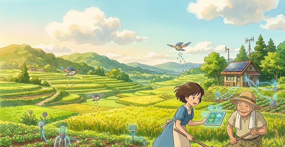
This transformation is driven by Smart Farming Technologies. By integrating high-tech tools into daily field operations, agriculture is shifting from generalized, bulk management to data-driven precision cultivation.
Smart farming allows you to monitor and treat individual square meters of your land as unique zones. This comprehensive guide details the advanced ag-tech innovations that can optimize your resource efficiency, minimize environmental impact, and maximize your overall crop yields.
The Rise of Precision Agriculture: Moving from Guesswork to Data
At its core, smart farming is about data collection and strategic execution. Traditional farming practices treat an entire 50-acre field as a uniform block. Every acre receives the exact same volume of seed, water, and fertilizer. However, anyone who has worked the land knows that soil structure, topography, and moisture retention vary significantly across a single property.
Precision agriculture addresses these variations directly. By deploying a network of connected technologies, farmers can map field variability and apply inputs in precise, targeted amounts.
Modern autonomous machinery and drone data networks working together in precision agriculture. Source: Advanced Navigation
Instead of over-fertilizing rich soil zones or leaving poor sandy zones under-nourished, smart farming ensures that resources are allocated exactly where they will generate the highest biological and financial return.
1. IoT Soil and Weather Sensors: The Central Nervous System of the Farm
You cannot optimize what you do not measure. Internet of Things (IoT) sensors serve as the eyes and ears of a modern digital farm, gathering continuous, real-time metrics directly from the dirt and the air.
In-Situ Capacitance Soil Probes
Placing multi-depth electronic sensors throughout your root zones eliminates guesswork from irrigation schedules. These probes measure the volumetric water content and electrical conductivity at multiple depths (such as 15cm, 30cm, and 60cm).
By tracking exactly how fast water drops through your soil profile, you can avoid underwatering stress and prevent overwatering, which saves money and stops nutrients from leaching past the roots.
Hyper-Local Weather Stations
Relying on generic regional weather forecasts can lead to costly mistakes. On-farm, connected weather stations log real-time temperature, ambient humidity, wind speed, and leaf wetness.
The Disease Risk Matrix: Many fungal and bacterial plant pathogens only germinate when specific temperature and leaf wetness duration thresholds are met. Real-time micro-climate tracking allows software to predict disease outbreaks up to 48 hours before they physically manifest, enabling preventative treatment.
2. Agricultural Drones and Satellite Multispectral Imaging
Looking at a field from ground level makes it difficult to spot early crop stress until the damage has already spread. Aerial imaging technologies give growers a birds-eye view of plant health across thousands of acres in seconds.
Multi-Rotor and Fixed-Wing Ag Drones
Modern agricultural drones are equipped with specialized multispectral cameras. These cameras capture light wavelengths that are invisible to the human eye, specifically near-infrared (NIR) and shortwave infrared light.
[Drone Airborne Scan] ──► [Reflected NIR Light Captured] ──► [NDVI Software Processing] ──► [Targeted Field Map]
Understanding the NDVI Index
Once a drone or satellite scans a field, the raw data is converted into a Normalized Difference Vegetation Index (NDVI) map. Healthy, photosynthesis-dense leaves reflect high amounts of near-infrared light and absorb red light. Stressed, dehydrated, or pest-damaged plants reflect far less NIR light.
Reviewing an weekly NDVI map allows you to pinpoint exact zones experiencing nitrogen deficiencies, irrigation leaks, or insect damage long before visual yellowing occurs on the ground. This allows for hyper-targeted field interventions that save time and chemical costs.
3. Variable Rate Technology (VRT) and Autonomous Machinery
Gathering data with sensors and drones is highly valuable, but you need a way to act on that information at scale. Variable Rate Technology (VRT) bridges the gap by connecting digital field maps directly to automated tractor implements.
Variable Rate Seeding (VRS)
Different zones within a single field can support different plant populations. In highly fertile, moisture-rich lowland zones, a variable-rate seeder automatically increases the number of seeds planted per acre to maximize yield potential. As the tractor climbs onto a rocky, low-fertility ridge, the seeder automatically thins out the seed spacing, preventing overcrowded crops from competing for scarce resources.
Variable Rate Fertigation and Spraying
Instead of broadcasting chemicals evenly, VRT-enabled sprayers adjust their output on the fly based on GPS location data. When the machinery passes over a highly productive zone mapped by your drone, it applies the optimal nutrient dose. When it crosses a high-fertility area that requires no intervention, the nozzles shut off completely.
This level of precision can reduce overall fertilizer and pesticide expenditures by 15% to 30%, protecting your profit margins and preventing chemical runoff into local water systems.
4. Smart Irrigation Management and Automated Valve Networks
Water is quickly becoming one of the scarcest and most heavily regulated resources in global agriculture. Smart irrigation systems replace manual valve turning with closed-loop, automated networks driven by environmental data.
Evapotranspiration (ET) Modeling
Advanced farm management software calculates daily crop water loss by combining solar radiation, wind speed, relative humidity, and the specific growth stage of the plant. This data provides an exact measurement of the millimeters of water that evaporated from the soil and transpired through the crop over the past 24 hours, allowing you to replace only what was actually lost.
Automated Cloud-Connected Valving
By linking your multi-depth soil moisture sensors directly to automated solar-powered solenoid valves, irrigation runs on autopilot within your exact parameters:
| Soil Moisture Level | System Status | Action Taken |
|---|---|---|
| Below Critical Point | Active Trigger | Solenoid valves open automatically; drip irrigation begins. |
| Optimal Root Capacity | Saturation Cap | Valves close immediately; prevents pooling and anaerobic root stress. |
| Heavy Rainfall Detected | Override Mode | System pauses all scheduled watering runs until the soil dries. |
Roadmap to Smart Tech Integration
Upgrading your farm with advanced technologies does not mean you need to buy a fleet of autonomous machinery overnight. A phased approach allows you to build out your tech infrastructure as your revenue grows:
1
High-Resolution Soil & Digital Mapping
Phase 1: Basic Assessment
1.High-Resolution Soil & Digital Mapping:Phase 1: Basic Assessment.
Establish your digital baseline by running soil electrical conductivity (EC) scans and collecting historical satellite imagery to identify your farm’s distinct management zones.
2
Telemetric Sensor Implementation
Phase 2: Active Monitoring
2.Telemetric Sensor Implementation:Phase 2: Active Monitoring.
Deploy IoT multi-depth soil moisture probes and a connected micro-climate weather station in your most variable zones to begin tracking real-time environmental data.
3
Farm Management Software Integration
Phase 3: Centralization
3.Farm Management Software Integration:Phase 3: Centralization.
Consolidate your soil data, weather metrics, and satellite imagery into a single Farm Management Information System (FMIS) dashboard accessible from your phone.
4
Variable Rate Implement Upgrades
Phase 4: Field Automation
4.Variable Rate Implement Upgrades:Phase 4: Field Automation.
Equip your existing tractors or sprayers with GPS-guided Variable Rate Controllers to automatically adjust your seeding and fertilizer application rates in real time.
Frequently Asked Questions (FAQs)
What is the average return on investment (ROI) for smart farming technology?
While startup costs vary based on your farm’s size, most commercial operations see a full return on investment within 12 to 24 months. This financial recovery is driven by a 15-20% reduction in water and fertilizer costs, paired with a measurable increase in overall harvest yields due to reduced plant stress.
Do I need high-speed internet across my entire property to use IoT sensors?
No. Modern agricultural IoT devices use long-range, low-power communication protocols like LoRaWAN or cellular NB-IoT. These systems can transmit data packages over several miles from the field back to a single central base station connected to your home router.
How do drone maps differ from standard satellite imagery?
Satellite imagery is excellent for broad, regional monitoring, but it can be delayed by cloud cover and often provides lower resolution. Drones can fly underneath clouds at any time, producing high-resolution, centimeter-level imagery that allows you to inspect individual leaves and spot early pest issues.
Can smart farming systems assist with organic compliance tracking?
Yes. Farm Management Information Systems (FMIS) automatically log every field entry, input volume, and application date with GPS verification. This automated documentation simplifies the record-keeping required for organic audits and sustainability certifications.
Conclusion
Maximizing crop yields in today’s demanding agricultural market requires a shift toward high-precision, data-driven management. Continuing to apply uniform inputs across variable fields increases costs and leaves significant yield potential untapped on your land.
By utilizing connected IoT soil probes, leveraging aerial NDVI imagery, and executing field tasks with variable rate automation, you can optimize resource efficiency and lower input expenses. Embracing smart farming technologies is about more than just buying high-tech gadgets; it is about combining advanced data with sound agronomic principles to build a more resilient, productive, and profitable agribusiness.